Have questions?
what is simTainment™?
request more information
Product Brochure
download now
-
- discover our unique selection of simTainment™ products for Microsoft Flight Simulator and X-Plane
- GTN 750/650 Touch™
- GNS 530W/430W V2™
- General Aviation T-Stack
- Analogue Navigation Gauges
- Wx500 XP™ Weather Radar
- See all
-
- combining traditional training and simulation expertise with novel approaches from the gaming industry to provide RealTime Training™
- RealTime Training™
- Microsoft ESP™
- See all
-
- we serve consumers, developers and enterprises helping deliver lowest overall cost and greatest competitive advantage
- Services we offer
- Industries we serve
- White papers
- About us
Complete Simulation with no compromises
The industry's best-selling integrated TAWS for corporate, regional and air transport markets outperforms cumbersome remote-mount TAWS systems. Enhancing safety and situational awareness, the revolutionary ST3400 TAWS/RMI features terrain maps, topographic maps, navigation waypoint maps and TCAS data.
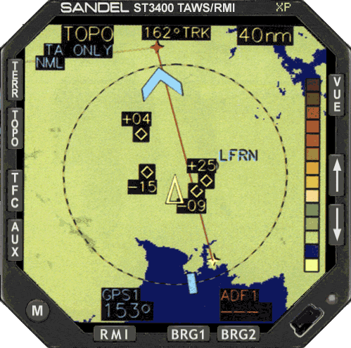
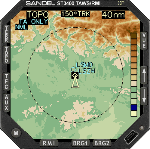 ST3400 XP Topographic Map
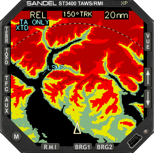 Visualize Terrain Relative Height
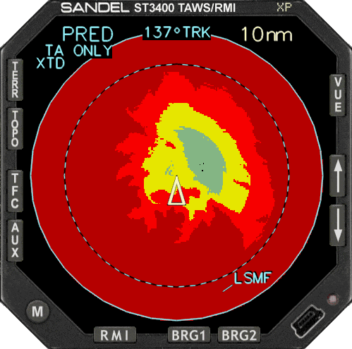 Projected path to terrain during climb
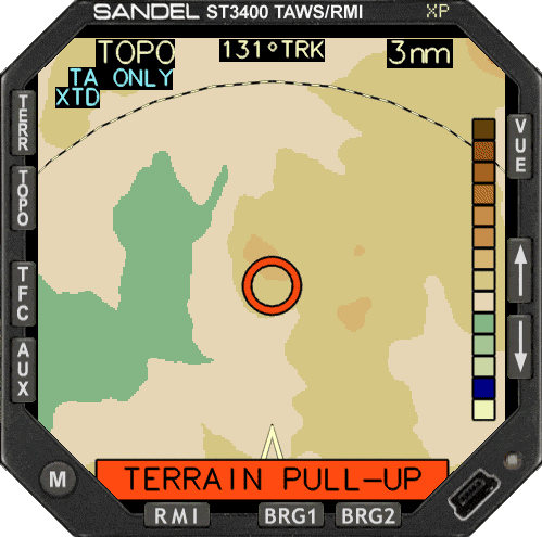 Take Evasive Actions
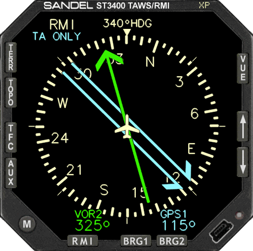 Get bearings with the RMI mode
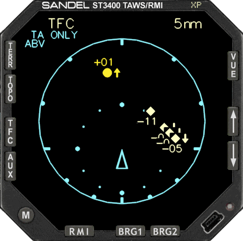 Watch aircraft around you
 Combines Terrain, Navigation and Traffic